|
|
|
|

|
ADSIC Organizes Workshop On ‘Using Satellite Imagery In Geospatial Information Systems’
Published Mar 28, 2012
|
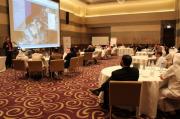
The Abu Dhabi Systems & Information Centre (ADSIC) organized recently a technical workshop entitled ‘Using Satellite Imagery in Geospatial Data Systems’ which was well-attended by representatives of the Abu Dhabi Spatial Data Infrastructure Program (AD-SDI) member entities and industry experts.
Abdul Kareem Al Raeesi, Executive Manager of the Spatial Data Centre, said: “The Spatial Data Program is a fundamental pillar under the Abu Dhabi’s e-government strategy. This workshop, organized by Abu Dhabi Systems & Information Centre in collaboration with the “International Institute for Environmental Research” ESRI forms part of a series of specialized seminars and events intended to enhance knowledge on and raise the GeoMaturity level. It will enlighten participants on the importance of spatial data acquired through the use of satellite images in different processes
The workshop was held in cooperation with Environmental Systems Research Institute, Inc. (ESRI) and is part of ongoing efforts to raise awareness on geospatial data and the importance of using satellite imagery for various purposes. An international industry expert was invited to present the latest developments and global trends in the geospatial services field and provide examples of international best practices.
During the workshop, Peter Becker from the Institute of Environmental Research (ESRI presented the best practices and applications for satellite imagery. The Space Reconnaissance Centre also addressed the stages of creating and processing satellite images, their requirements and multiple uses within various sectors, and programs that utilize satellite images.
Bayanat for Mapping & Surveying Services also presented the use of digital aerial sensors in the production of spatial data, the latest devices in aerial photography and marine survey, and the preparation of relevant spatial data. The workshop included a presentation by the Emirates Institution for Advanced Science and Technology (EIAST) which gave an overview of the capabilities, applications and functions of the Dubai Sat-1 satellite, and revealed the characteristics and advantages of the new Dubai Sat-2.
The discussions that took place within the workshop reflected the importance of satellite imagery in various day-to-day government operations and highlighted the value of such sessions in identifying the latest global developments as well as sharing expert opinions on how to raise awareness on geospatial services in Abu Dhabi.
The strategic objectives of the Abu Dhabi Spatial Data Infrastructure Program include raising geospatial awareness in the community and granting government, businesses and community members free access to electronic information and geospatial services. Moreover, by collecting geospatial data and providing related services and using and sharing them with governmental and non-governmental sectors, the program is able to reduce duplication and redundancy in projects, enhance coordination among various stakeholders, and provide support to decision-making processes.
AD-SDI program seeks to achieve these goals through core values that include efficiency, strong focus on clients, excellence, innovation, sustainability, teamwork, and transparency. The program includes several areas of focus such as the GIS capacity building of members, establishing alliances and partnerships with international entities working in the IT field and Geospatial Information Technology and Services (GITS), as well as exploring new horizons for enabling spatial e-government services supporting decision making processes.
Since its inception in 2007, AD-SDI program has been supervising the implementation of spatially-enabled government e-services in coordination with the emirate’s government entities. This has helped it increase the growth of the AD-SDI community to 52 entities, while enhancing the participation of the private sector and academia.
Posted by
VMD - [Virtual Marketing Department]
|
|
|

